
Voices
Are we leaving men and boys behind?
At Creative Equal’s RISE event, industry leaders consider how to reframe boys and men in marketing
Google's 30 year timelapse
Google unveils a 3-Decade time-lapse of the earth, by Jeffrey Kluger
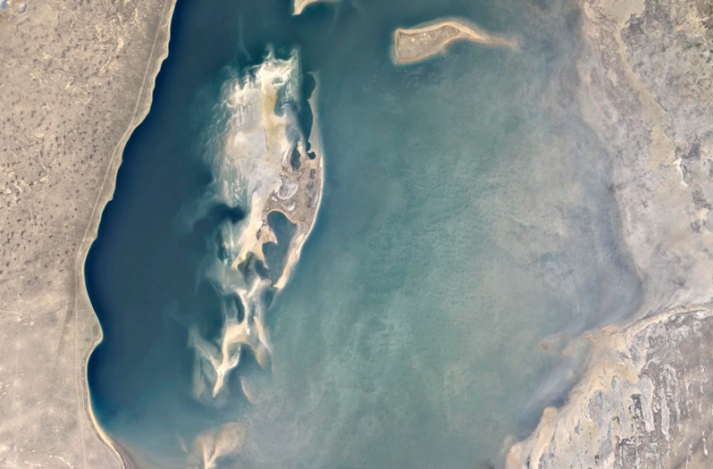
The mountain that’s here today ought to be here tomorrow. The river that meanders along the boundary of your state or your nation will be meandering into the future. If you were in orbit, however, things would look very different—especially if you were in orbit for a few decades at a time. Since 1972, the Landsat satellites—a rotating fleet of four different spacecraft—have kept exactly that kind of long-term vigil, circling the Earth and scanning the surface for the incremental ways the human population is changing the only home it’s got. They’ve been aided since 2015 by the European Space Agency’sCopernicus Program and itsSentinel-2A satellite.
In the years all of the satellites have been flying they’ve taken millions upon millions of high-definition images, whichNASA and the U.S. Geological Survey (USGS) have collated and assembled into something of a flip book that reveals the slow but steady alteration of our world. What the two science agencies started, the folks at Google have finished, turning the usually choppy, sometimes-hazy images into smoothly streaming videos, revealing decades of topographic changes in 10-second sweeps.
To find out more visit TIME Timelapse powered by Google
Looks like you need to create a Creativebrief account to perform this action.
Create account Sign inLooks like you need to create a Creativebrief account to perform this action.
Create account Sign in